How Directional Drilling Works in Atlanta's Piedmont
Red clay, saprolite, and the granite underneath
The metro's ground story reads top-down: red clay residuum at the surface, grading into saprolite — parent rock weathered in place that still drills like soil — then a transition band of partially weathered rock, then hard granite and gneiss. Every layer is drillable; the trade skill is that the boundaries rise and fall unpredictably, and famous local outcrops are just the places where the bottom layer reached daylight.
For a bore, that means the honest unit of pricing is footage-by-ground-class, not footage alone. Saprolite footage, PWR footage, and rock footage are three different products with three different tooling and pace realities, and a quote that admits it protects both sides.
The sequence, with piedmont adjustments
Standard HDD bones — Georgia 811 locates plus private designating, potholes on every crossing utility, pilot bore, reaming to about one and a half times product, pullback, restoration. The piedmont adjustments: probe or geotech where the alignment allows, transition tooling staged before it's needed, entry/exit engineered to real grades, and erosion control done to Georgia's standards because red clay runoff is visible from space and regulators know it.
Fluid behavior differs from the Gulf-coast stereotype: less water-table fight, more fracture-path awareness in weathered rock. Annular pressure discipline still rules; the paths to daylight are just made of different geology.
The permit stack, Georgia edition
City streets carry municipal ROW permits; county roads carry county public-works permits, and this metro has twenty-nine counties' worth of variation. State routes run through GDOT's utility permitting under the accommodation policy. Railroads permit their own crossings on their own timeline. Named water can add federal recreation-area review on the Chattahoochee corridor and stream-buffer rules almost everywhere. The quote names every authority your alignment touches, because each one is schedule.
What ~10,000 quoted crossings taught us to ask
Our national intake has answered 50,000+ boring calls and quoted close to 10,000 crossings, and the Atlanta-relevant pattern is blunt: the expensive surprises are rock and permits, in that order. So the scope sheet asks about both before anything gets priced — what the ground data shows, who owns the crossing — and holds the number at Pending Review until a person has priced your actual alignment. Instant quotes in piedmont ground are fiction with a font.
Straight answers
Will you hit rock on my bore?
In this metro the honest answer is 'plan as if you might.' Depth to rock varies block by block; probe or geotech data turns the question from gamble to plan, and our quotes price ground classes explicitly so a transition mid-shot changes the math predictably instead of catastrophically.
How deep do bores run under Atlanta-area roads?
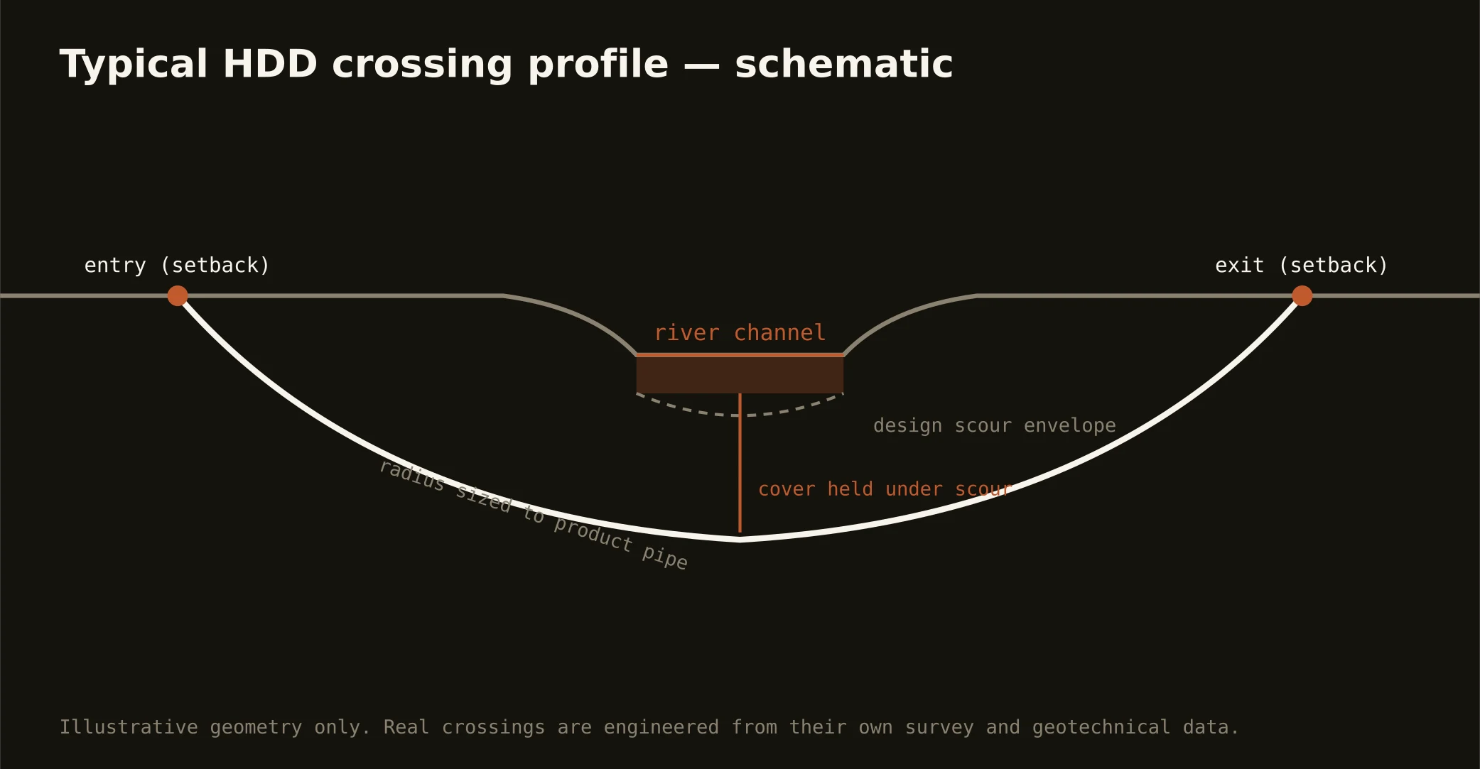
Cover follows the authority's standard — municipal, county, or GDOT accommodation policy — and sits below everything potholed on the alignment. Engineered crossings (rivers, rail) run deeper, set by scour and the owner's requirements, and the bore plan states the number.
Can you bore in stream-buffer zones?
Crossing under a buffered stream is often exactly what HDD is for — but the buffer rules govern surface disturbance, so pits and workspace get sited outside the buffer and the erosion-control plan gets built to Georgia's standard. We flag buffer questions at scope so the review is in the schedule.
Ready to put a number on a real crossing? Send the scope — a person prices it.